
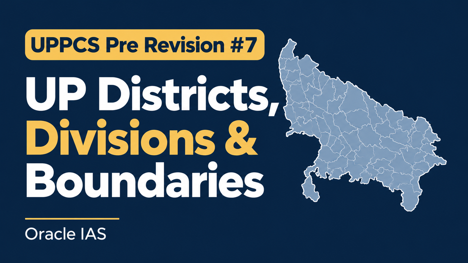
Uttar Pradesh is India’s most populous state and has 75 districts and 18 administrative divisions. Its geography is especially important for UPPCS Prelims because questions can combine district statistics, administrative boundaries, neighbouring states, international borders, tehsils, latitude and longitude, and map-based locations.
This article provides a district-wise reference table and a focused revision of the geographical facts most likely to matter in examinations.
1. Uttar Pradesh: geographical and administrative profile
| Indicator | Fact |
|---|---|
| Capital | Lucknow |
| Total geographical area | 2,40,928 sq km |
| Area rank among Indian states | Fourth |
| Population (Census 2011) | 19,98,12,341 |
| Population density (Census 2011) | 829 persons per sq km |
| Districts | 75(76 during Kumbh, when the Kumbh mela is organised as a seperate district) |
| Administrative divisions | 18 |
| Tehsils in the Statistical Diary 2022 | 351, as at 31 March 2022 |
| Community Development Blocks in the Statistical Diary 2022 | 826, as at 31 March 2022 |
| International neighbour | Nepal |
| Indian states/UT adjoining UP | Eight states and the National Capital Territory of Delhi |
| Latitude extent | Approximately 23°52′ N to 31°28′ N |
| Longitude extent | Approximately 77°31′ E to 84°39′ E |
| Principal river systems | Ganga, Yamuna, Ghaghara, Gomti, Ramganga, Rapti, Gandak, Betwa, Ken and Son |
2. District-wise area, population, density and tehsils
The following table combines the four most useful statistics for district-based questions. Population and density are Census 2011 figures; tehsil counts are dated 31 March 2022.
| No. | District | Division | Area (sq km) | Population (2011) | Density per sq km | Tehsils (2022) |
|---|---|---|---|---|---|---|
| 1 | Saharanpur | Saharanpur | 3,689 | 34,66,382 | 940 | 5 |
| 2 | Muzaffarnagar | Saharanpur | 2,796 | 28,29,865 | 1,012 | 4 |
| 3 | Shamli | Saharanpur | 1,212 | 13,13,647 | 1,084 | 3 |
| 4 | Bijnor | Moradabad | 4,561 | 36,82,713 | 807 | 5 |
| 5 | Moradabad | Moradabad | 2,271 | 31,26,507 | 1,377 | 4 |
| 6 | Sambhal | Moradabad | 2,453 | 21,99,774 | 897 | 3 |
| 7 | Rampur | Moradabad | 2,367 | 23,35,819 | 987 | 6 |
| 8 | Amroha | Moradabad | 2,249 | 18,40,221 | 818 | 4 |
| 9 | Meerut | Meerut | 2,559 | 34,43,689 | 1,346 | 3 |
| 10 | Baghpat | Meerut | 1,321 | 13,03,048 | 986 | 3 |
| 11 | Ghaziabad | Meerut | 910 | 33,43,334 | 3,674 | 3 |
| 12 | Hapur | Meerut | 660 | 13,38,311 | 2,028 | 3 |
| 13 | Gautam Buddha Nagar | Meerut | 1,282 | 16,48,115 | 1,286 | 3 |
| 14 | Bulandshahr | Meerut | 4,512 | 34,99,171 | 776 | 7 |
| 15 | Aligarh | Aligarh | 3,650 | 36,73,889 | 1,007 | 5 |
| 16 | Hathras | Aligarh | 1,840 | 15,64,708 | 850 | 4 |
| 17 | Mathura | Agra | 3,340 | 25,47,184 | 763 | 5 |
| 18 | Agra | Agra | 4,041 | 44,18,797 | 1,094 | 6 |
| 19 | Firozabad | Agra | 2,407 | 24,98,156 | 1,038 | 5 |
| 20 | Etah | Aligarh | 2,431 | 17,74,480 | 730 | 3 |
| 21 | Kasganj | Aligarh | 1,955 | 14,36,719 | 735 | 3 |
| 22 | Mainpuri | Agra | 2,760 | 18,68,529 | 677 | 6 |
| 23 | Budaun | Bareilly | 4,234 | 31,27,621 | 739 | 5 |
| 24 | Bareilly | Bareilly | 4,120 | 44,48,359 | 1,080 | 6 |
| 25 | Pilibhit | Bareilly | 3,686 | 20,31,007 | 551 | 5 |
| 26 | Shahjahanpur | Bareilly | 4,388 | 30,06,538 | 685 | 5 |
| 27 | Lakhimpur Kheri | Lucknow | 7,680 | 40,21,243 | 524 | 7 |
| 28 | Sitapur | Lucknow | 5,743 | 44,83,992 | 781 | 7 |
| 29 | Hardoi | Lucknow | 5,986 | 40,92,845 | 684 | 5 |
| 30 | Unnao | Lucknow | 4,558 | 31,08,367 | 682 | 6 |
| 31 | Lucknow | Lucknow | 2,528 | 45,89,838 | 1,816 | 5 |
| 32 | Rae Bareli | Lucknow | 4,043 | 29,03,507 | 718 | 6 |
| 33 | Amethi | Ayodhya | 2,329 | 18,67,678 | 802 | 4 |
| 34 | Farrukhabad | Kanpur | 2,181 | 18,85,204 | 864 | 3 |
| 35 | Kannauj | Kanpur | 2,093 | 16,56,616 | 792 | 4 |
| 36 | Etawah | Kanpur | 2,311 | 15,81,810 | 685 | 6 |
| 37 | Auraiya | Kanpur | 2,016 | 13,79,545 | 684 | 3 |
| 38 | Kanpur Dehat | Kanpur | 3,021 | 17,96,184 | 595 | 6 |
| 39 | Kanpur Nagar | Kanpur | 3,155 | 45,81,268 | 1,452 | 4 |
| 40 | Jalaun | Jhansi | 4,565 | 16,89,974 | 370 | 5 |
| 41 | Jhansi | Jhansi | 5,024 | 19,98,603 | 398 | 5 |
| 42 | Lalitpur | Jhansi | 5,039 | 12,21,592 | 242 | 5 |
| 43 | Hamirpur | Chitrakoot Dham | 4,021 | 11,04,285 | 275 | 4 |
| 44 | Mahoba | Chitrakoot Dham | 3,144 | 8,75,958 | 279 | 3 |
| 45 | Banda | Chitrakoot Dham | 4,408 | 17,99,410 | 408 | 5 |
| 46 | Chitrakoot | Chitrakoot Dham | 3,216 | 9,91,730 | 308 | 4 |
| 47 | Fatehpur | Prayagraj | 4,152 | 26,32,733 | 634 | 3 |
| 48 | Pratapgarh | Prayagraj | 3,717 | 32,09,141 | 863 | 5 |
| 49 | Kaushambi | Prayagraj | 1,779 | 15,99,596 | 899 | 3 |
| 50 | Prayagraj | Prayagraj | 5,482 | 59,54,391 | 1,086 | 8 |
| 51 | Barabanki | Ayodhya | 4,402 | 32,60,699 | 741 | 6 |
| 52 | Ayodhya | Ayodhya | 2,341 | 24,70,996 | 1,056 | 5 |
| 53 | Ambedkar Nagar | Ayodhya | 2,350 | 23,97,888 | 1,020 | 5 |
| 54 | Sultanpur | Ayodhya | 2,673 | 24,31,491 | 910 | 5 |
| 55 | Bahraich | Devipatan | 5,237 | 34,87,731 | 666 | 6 |
| 56 | Shravasti | Devipatan | 1,640 | 11,17,361 | 681 | 3 |
| 57 | Balrampur | Devipatan | 3,349 | 21,48,665 | 642 | 3 |
| 58 | Gonda | Devipatan | 4,003 | 34,33,919 | 858 | 4 |
| 59 | Siddharthnagar | Basti | 2,895 | 25,59,297 | 884 | 5 |
| 60 | Basti | Basti | 2,688 | 24,64,464 | 917 | 4 |
| 61 | Sant Kabir Nagar | Basti | 1,646 | 17,15,183 | 1,042 | 3 |
| 62 | Maharajganj | Gorakhpur | 2,952 | 26,84,703 | 910 | 4 |
| 63 | Gorakhpur | Gorakhpur | 3,321 | 44,40,895 | 1,337 | 7 |
| 64 | Kushinagar | Gorakhpur | 2,905 | 35,64,544 | 1,227 | 6 |
| 65 | Deoria | Gorakhpur | 2,540 | 31,00,946 | 1,221 | 5 |
| 66 | Azamgarh | Azamgarh | 4,054 | 46,13,913 | 1,138 | 8 |
| 67 | Mau | Azamgarh | 1,713 | 22,05,968 | 1,288 | 4 |
| 68 | Ballia | Azamgarh | 2,981 | 32,39,774 | 1,087 | 6 |
| 69 | Jaunpur | Varanasi | 4,038 | 44,94,204 | 1,113 | 6 |
| 70 | Ghazipur | Varanasi | 3,377 | 36,20,268 | 1,072 | 7 |
| 71 | Chandauli | Varanasi | 2,541 | 19,52,756 | 769 | 5 |
| 72 | Varanasi | Varanasi | 1,535 | 36,76,841 | 2,395 | 3 |
| 73 | Bhadohi | Vindhyachal | 1,015 | 15,78,213 | 1,555 | 3 |
| 74 | Mirzapur | Vindhyachal | 4,405 | 24,96,970 | 567 | 4 |
| 75 | Sonbhadra | Vindhyachal | 6,905 | 18,62,559 | 270 | 4 |
Source basis: Uttar Pradesh Statistical Diary 2022, district-wise area and population tables and the district-wise tehsil table. District population figures are Census 2011. The tehsil counts are historical administrative counts, not a guarantee of the present-day number. The UP government’s statistical portal and geoportal are useful for checking updated administrative records.
3. The 18 divisions of Uttar Pradesh and their districts
Uttar Pradesh is divided into 18 administrative divisions. Learn the districts under each division as a group; this is more effective for map-based revision than memorising district names alphabetically.
| Division | Districts | Number of districts |
|---|---|---|
| Saharanpur | Saharanpur, Muzaffarnagar, Shamli | 3 |
| Meerut | Meerut, Baghpat, Ghaziabad, Bulandshahr, Gautam Buddha Nagar, Hapur | 6 |
| Moradabad | Bijnor, Moradabad, Rampur, Amroha, Sambhal | 5 |
| Agra | Mathura, Agra, Firozabad, Mainpuri | 4 |
| Aligarh | Aligarh, Hathras, Etah, Kasganj | 4 |
| Bareilly | Budaun, Bareilly, Pilibhit, Shahjahanpur | 4 |
| Lucknow | Lakhimpur Kheri, Sitapur, Hardoi, Unnao, Lucknow, Rae Bareli | 6 |
| Kanpur | Farrukhabad, Kannauj, Etawah, Auraiya, Kanpur Dehat, Kanpur Nagar | 6 |
| Jhansi | Jalaun, Jhansi, Lalitpur | 3 |
| Chitrakoot Dham | Hamirpur, Mahoba, Banda, Chitrakoot | 4 |
| Prayagraj | Fatehpur, Pratapgarh, Prayagraj, Kaushambi | 4 |
| Devipatan | Bahraich, Gonda, Shravasti, Balrampur | 4 |
| Ayodhya | Barabanki, Ayodhya, Ambedkar Nagar, Sultanpur, Amethi | 5 |
| Basti | Siddharthnagar, Basti, Sant Kabir Nagar | 3 |
| Gorakhpur | Maharajganj, Gorakhpur, Deoria, Kushinagar | 4 |
| Azamgarh | Mau, Azamgarh, Ballia | 3 |
| Varanasi | Varanasi, Ghazipur, Jaunpur, Chandauli | 4 |
| Vindhyachal | Bhadohi, Mirzapur, Sonbhadra | 3 |
4. International boundary: Uttar Pradesh and Nepal
Uttar Pradesh shares an international boundary with Nepal to the north. The commonly cited list contains seven UP districts along the Nepal border.
| No. | District | Border significance |
|---|---|---|
| 1 | Pilibhit | Terai region; Gauriphanta is an important border crossing in the wider border region |
| 2 | Lakhimpur Kheri | Large Terai district; includes the Dudhwa landscape |
| 3 | Bahraich | Rupaidiha is an important India–Nepal trade and movement point |
| 4 | Shravasti | Nepal-facing district in the Devipatan region |
| 5 | Balrampur | Nepal-facing district in the Terai belt |
| 6 | Siddharthnagar | Nepal-facing district; Barhni is an important crossing |
| 7 | Maharajganj | Nepal-facing district; Sonauli is a major border crossing |
High-yield facts
- The international boundary is with Nepal, not Bhutan or China.
- The border is an open international boundary under the India–Nepal relationship, although designated crossings and customs facilities regulate particular types of movement.
- Important border locations to recognise include Rupaidiha, Sonauli, Barhni and the Gauriphanta area.
- Do not confuse a border district with a border town or a designated Integrated Check Post.
5. Boundaries with neighbouring Indian states and Delhi
UP is often tested as a state with a particularly large number of neighbours. It shares a boundary with eight Indian states and one Union Territory—Delhi—as well as Nepal internationally.
The district lists below are useful for map practice. Because boundary descriptions can vary with map scale and district reorganisation, use an official Survey of India or Census administrative map if a question depends on a very small boundary segment.
| Neighbour | UP districts commonly listed along the boundary | Key exam point |
|---|---|---|
| Uttarakhand | Saharanpur, Muzaffarnagar, Bijnor, Moradabad, Rampur, Bareilly, Pilibhit | Northern and north-western side |
| Haryana | Saharanpur, Shamli, Baghpat, Gautam Buddha Nagar, Aligarh, Mathura | Western boundary; the Yamuna is an important boundary river in parts |
| Delhi (NCT) | Baghpat, Ghaziabad, Gautam Buddha Nagar | Delhi is a Union Territory, not a state |
| Rajasthan | Agra, Mathura | South-western side |
| Madhya Pradesh | Agra, Etawah, Jalaun, Jhansi, Lalitpur, Mahoba, Banda, Chitrakoot, Prayagraj, Mirzapur, Sonbhadra | Long southern and south-western boundary |
| Bihar | Maharajganj, Kushinagar, Deoria, Ballia, Ghazipur, Chandauli, Sonbhadra | Eastern boundary region |
| Chhattisgarh | Sonbhadra | Sonbhadra is the key district to remember |
| Jharkhand | Sonbhadra | Sonbhadra is the key district to remember |
| Himachal Pradesh | Saharanpur | shortest boundary of UP with other state |
Important boundary clusters
Sonbhadra is exceptionally important. It lies in the south-eastern part of Uttar Pradesh and is commonly identified in UP geography references as adjoining Madhya Pradesh, Chhattisgarh, Jharkhand and Bihar. It is also a district of major mineral and energy significance.
Saharanpur is important in the north-west. It lies near the boundary region involving Uttarakhand and Haryana, anHimachal Pradesh.
Agra and Mathura are the key districts to remember for the Rajasthan boundary.
6. Latitude, longitude and extreme points
The state’s geographical extent is approximately 23°52′ N to 31°28′ N latitude and 77°31′ E to 84°39′ E longitude.
| Geographic feature | Exam-oriented fact |
|---|---|
| Northern extent | Around 31°28′ N |
| Southern extent | Around 23°52′ N |
| Western extent | Around 77°31′ E |
| Eastern extent | Around 84°39′ E |
| General north–south orientation | From the Shivalik/Terai region toward the Vindhyan and Sonbhadra region |
| General east–west orientation | From the western plains toward the eastern Gangetic plain and the Bihar boundary |
Extreme districts
| Direction | District commonly cited | Memory cue |
|---|---|---|
| Northern side | Saharanpur | Upper north-western corner |
| Southern side | Sonbhadra | Vindhyan plateau and southern border |
| Eastern side | Ballia | Near the eastern end of the state along the Ganga |
| Western side | Shamli | Western Uttar Pradesh |
7. District extremes: area, population and density
These comparisons are among the most useful quick facts in district geography.
| Question | Answer | Figure |
|---|---|---|
| Largest district by area | Lakhimpur Kheri | 7,680 sq km |
| Smallest district by area | Hapur | 660 sq km |
| Largest district by population (2011) | Prayagraj | 59,54,391 |
| Smallest district by population (2011) | Shravasti | 11,17,361 |
| Highest population density | Ghaziabad | 3,674 persons per sq km |
| Lowest population density | Sonbhadra | 270 persons per sq km |
| Largest division by number of districts | Meerut, Lucknow and Kanpur | 6 each |
| Smallest division by number of districts | Saharanpur, Jhansi, Basti and Azamgarh | 3 each |
8. Administrative hierarchy: state to village
For UPPCS, distinguish the administrative and rural-development units.
| Unit | Meaning |
|---|---|
| State | Uttar Pradesh |
| Division | Group of districts for divisional administration |
| District | Major district-level administrative unit |
| Tehsil / Subdivision | Revenue and land-administration unit within a district |
| Community Development Block | Rural-development and programme-implementation unit |
| Gram Panchayat | Elected rural local-government institution |
| Village | Settlement-level unit; not every village is a separate Gram Panchayat |
9. Regional geography: four broad economic regions
UP is also described through four broad economic regions
| Region | General location | Geographic character |
|---|---|---|
| Western UP | Upper Ganga–Yamuna Doab and adjoining western plains | Intensive agriculture, major urban and industrial belt |
| Central UP | Around Lucknow and the central Gangetic plain | Administrative and agricultural heartland |
| Eastern UP | Eastern Gangetic plain and the Nepal-facing Terai in the north-east | Dense rural settlement and major river systems |
| Bundelkhand | Southern and south-western plateau region | Rocky terrain, seasonal water stress and lower population density in several districts |
Regional contrasts to remember
- Western and central plains: Highly developed irrigation and transport networks in many areas.
- Eastern UP: Dense settlement and strong dependence on the Ganga and its tributaries.
- Terai belt: Northern districts near Nepal, with wetland, forest and alluvial landscapes.
- Bundelkhand and Sonbhadra: Plateau and rocky terrain, with mineral resources and different agricultural conditions from the central plains.
10. Rivers and boundaries
Rivers are important both as physical features and as boundaries. However, not every river forms an administrative boundary along its entire course.
| River / river system | Relevance to UP geography |
|---|---|
| Ganga | Major east–west river through the plains; flows past important cities including Kanpur, Prayagraj and Varanasi |
| Yamuna | Major western and southern river; forms parts of the boundary with Haryana and flows through the Agra region |
| Ghaghara | Important northern and eastern plain river system |
| Gomti | Important river of central and eastern UP; passes through Lucknow |
| Ramganga | Important river of the western and central Ganga plain |
| Rapti | Important in eastern UP and the Gorakhpur region |
| Gandak | Important near the eastern/north-eastern boundary region |
| Betwa and Ken | Important Bundelkhand rivers |
| Son | Associated with the south-eastern plateau and the Sonbhadra region |
.
Contact:
Call/WhatsApp 9997453844 for details
Join Our Preparation program:
He is a bibliophile,accomplished writer and a fitness enthusiast.
- UKPSC Physics: Heat, Thermodynamics & Thermal Physics (Solved PYQs & Notes) - October 15, 2026
- UPPCS Pre Revision #7: UP Districts, Divisions & Boundaries || Oracle IAS - October 14, 2026
- UKPSC Physics: Waves, Speed of Sound & Modern Particle Physics (Solved PYQs & Notes) - October 14, 2026